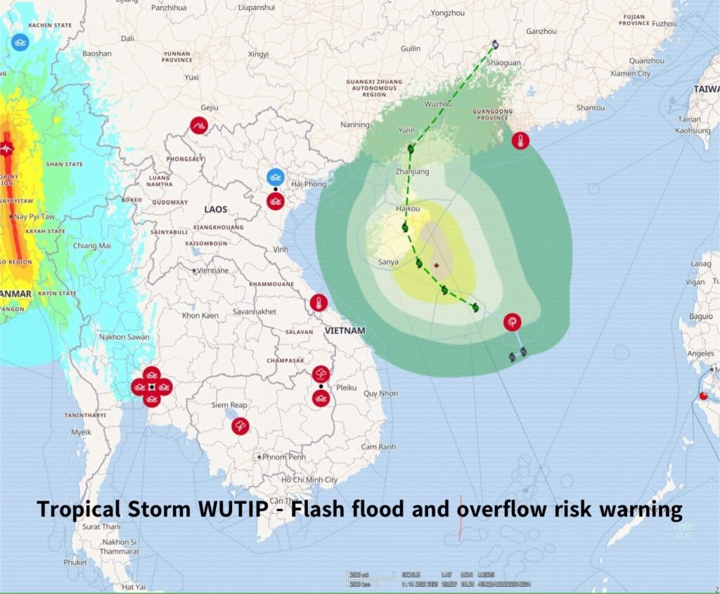
Tropical Storm WUTIP is currently located over the East sea of Viet Nam, with wind speeds of 62–74 km/h. The storm is moving slowly towards central Viet Nam at a speed of 10–15 km/h.
🔹 In the next 24–72 hours: The storm is expected to strengthen and continue moving towards central Viet Nam at a speed of 10 – 15km/h.
🔹 In the next 72–96 hours: The storm may then weaken and change direction, moving northward toward southern China at a speed of 15 – 20km/h.
🌧 From 11–13 June, thunderstorms and heavy to very heavy rainfall are expected in several areas in the LMB, including:
🇰🇭Cambodia: Northeastern and southwestern areas
🇱🇦Lao PDR: Northwestern and Central areas
🇹🇭Thailand: Northeastern areas
and the 3S Basin: Sekong, Sesan, and Srepok
⚠ Flash flood and overflow risk in the next 24 hours, especially in:
🇰🇭Cambodia: Mondul Kiri, Ratanakiri, Stung Treng
🇱🇦Lao PDR: Savannakhet, Saravane, Attapeu🇻🇳Viet Nam: Dak Lak, Gia Lai, Kon Tum